LandLens
Measure land on your phone with GPS or a satellite map
LandLens tells you how big a piece of land is. Walk the boundary with GPS or tap the corners on a satellite map, and you get acres, hectares, perimeter and distance. Save fields in folders and export them to KML, GeoJSON, Shapefile or PDF. No account needed. Works on iPhone, Android and the web.
Features
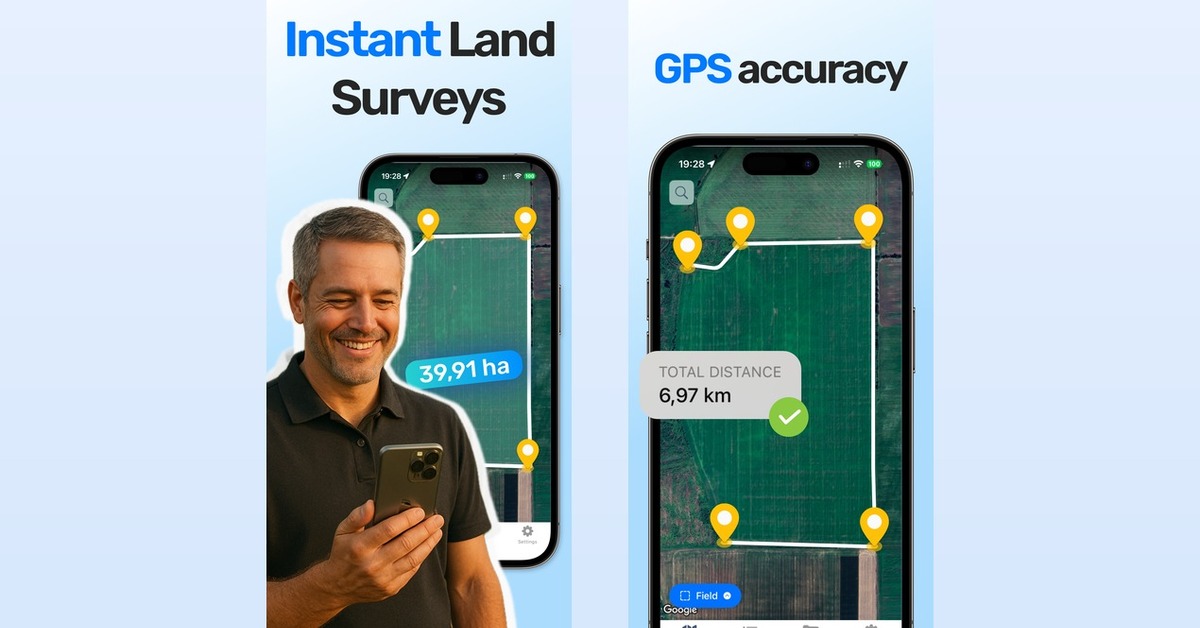
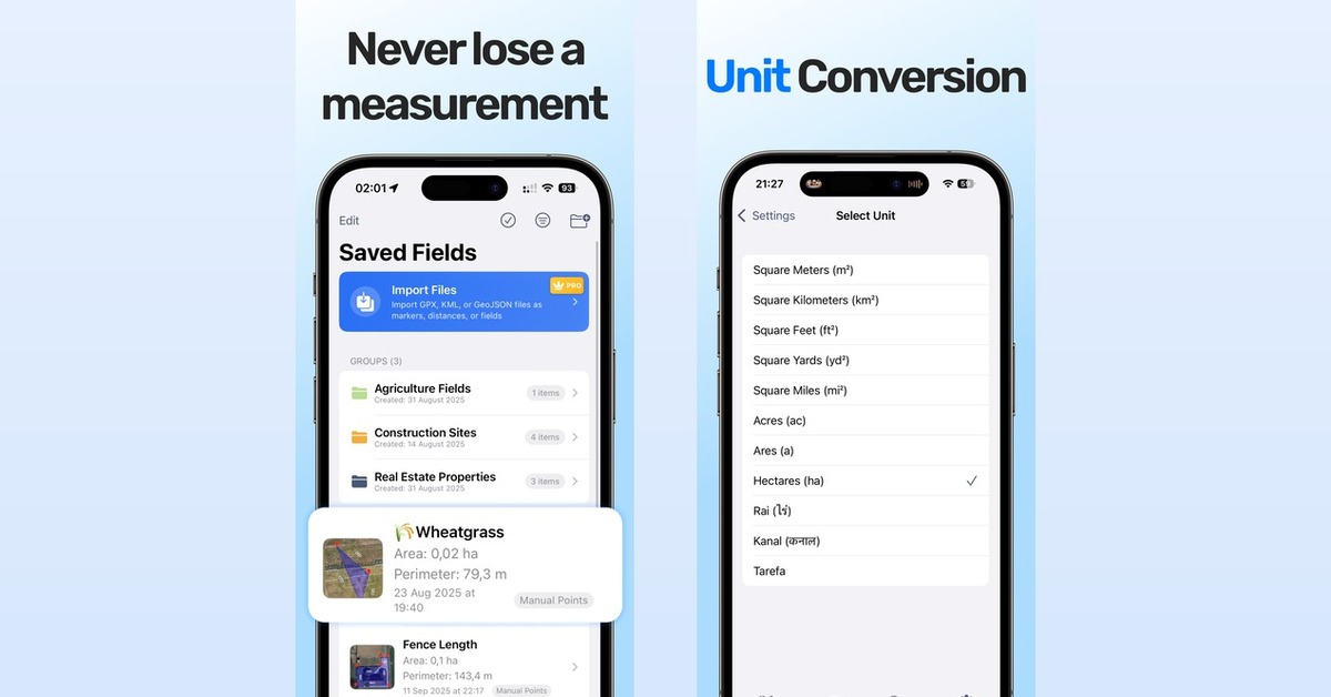
GPS walk mode or tap-to-draw on satellite imagery. Curved edges, circles and cut-out holes. Undo for every edit. Address and coordinate search. Export to KML, KMZ, GeoJSON, Shapefile and PDF.
Use Cases
Farmers checking field sizes before planting or buying inputs. Landowners and buyers sizing up a plot. Hunters mapping a lease. Contractors and landscapers measuring fence lines or lawn area for a quote.
Comments





The tap-to-draw mode with curved edges and cut-out holes is a big deal for irregular plots with ponds or buildings that shouldn't count toward the area. How accurate is GPS walk mode on a typical phone, and do you show an error margin or let users average multiple walks? For contractors quoting fence lines, a per-segment length label on the PDF export would also be really handy.



LandLens looks like a practical tool for anyone who needs to measure land quickly. The combination of GPS boundary tracking and satellite-map measurements makes it convenient for checking area, distance, and perimeter without specialized equipment. The export options are also useful for keeping and sharing land measurements.
Free exports to Shapefile and KML with no account is a strong reason to try this. An idea for the landscaper use case: let me tag parts of a boundary (fence, hedge, driveway) and get a length for each tag, so a quote comes straight off the measurement. Is the PDF export something a contractor could hand a client as is, with the satellite image and the numbers on one page?


This is one of those products that feels deceptively simple but solves a very real problem. I really like the combination of GPS walk mode and satellite-based drawing, especially with the ability to handle irregular boundaries and export to formats like KML and Shapefile. The fact that it works without requiring an account makes it even easier to try. Great work, Alina — definitely a useful tool for landowners, farmers, contractors, and anyone who needs quick measurements without specialized equipment. 🚀

The tap-to-draw mode with curved edges and cut-out holes stands out — irregular plots with ponds or tree lines are exactly where most measuring apps fall short. One suggestion: an option to save each measurement with a date and photo notes would help farmers compare field sizes across seasons. A quick share link for a boundary would also be handy when showing a plot to a buyer or contractor.

The combination of GPS walk mode and tap-to-draw on satellite imagery is smart — it covers both the in-the-field and at-the-desk workflows. Handling curved edges and cut-out holes shows real attention to how irregular plots actually look, and exporting to Shapefile/KML without an account removes a lot of friction for contractors. One thing I'd love to see: an offline mode for areas with poor signal, since that's exactly where you'd be walking boundaries.
Useful for buyers in the US: county assessors often list a different acreage than what's actually there, and that number drives the property tax bill. Being able to walk the boundary and export a PDF makes it easy to compare against the assessor's record before buying or appealing. Would a "compare with recorded acreage" field on the export be on your roadmap?
Useful for buyers in the US: county assessors often list a different acreage than what's actually there, and that number drives the property tax bill. Being able to walk the boundary and export a PDF makes it easy to compare against the assessor's record before buying or appealing. Would a "compare with recorded acreage" field on the export be on your roadmap?
Premium Products





























Sponsors
Buy

Awards
View all
Awards
View allComments
The tap-to-draw mode with curved edges and cut-out holes is a big deal for irregular plots with ponds or buildings that shouldn't count toward the area. How accurate is GPS walk mode on a typical phone, and do you show an error margin or let users average multiple walks? For contractors quoting fence lines, a per-segment length label on the PDF export would also be really handy.
LandLens looks like a practical tool for anyone who needs to measure land quickly. The combination of GPS boundary tracking and satellite-map measurements makes it convenient for checking area, distance, and perimeter without specialized equipment. The export options are also useful for keeping and sharing land measurements.
Free exports to Shapefile and KML with no account is a strong reason to try this. An idea for the landscaper use case: let me tag parts of a boundary (fence, hedge, driveway) and get a length for each tag, so a quote comes straight off the measurement. Is the PDF export something a contractor could hand a client as is, with the satellite image and the numbers on one page?
This is one of those products that feels deceptively simple but solves a very real problem. I really like the combination of GPS walk mode and satellite-based drawing, especially with the ability to handle irregular boundaries and export to formats like KML and Shapefile. The fact that it works without requiring an account makes it even easier to try. Great work, Alina — definitely a useful tool for landowners, farmers, contractors, and anyone who needs quick measurements without specialized equipment. 🚀
The tap-to-draw mode with curved edges and cut-out holes stands out — irregular plots with ponds or tree lines are exactly where most measuring apps fall short. One suggestion: an option to save each measurement with a date and photo notes would help farmers compare field sizes across seasons. A quick share link for a boundary would also be handy when showing a plot to a buyer or contractor.
The combination of GPS walk mode and tap-to-draw on satellite imagery is smart — it covers both the in-the-field and at-the-desk workflows. Handling curved edges and cut-out holes shows real attention to how irregular plots actually look, and exporting to Shapefile/KML without an account removes a lot of friction for contractors. One thing I'd love to see: an offline mode for areas with poor signal, since that's exactly where you'd be walking boundaries.
Useful for buyers in the US: county assessors often list a different acreage than what's actually there, and that number drives the property tax bill. Being able to walk the boundary and export a PDF makes it easy to compare against the assessor's record before buying or appealing. Would a "compare with recorded acreage" field on the export be on your roadmap?
Useful for buyers in the US: county assessors often list a different acreage than what's actually there, and that number drives the property tax bill. Being able to walk the boundary and export a PDF makes it easy to compare against the assessor's record before buying or appealing. Would a "compare with recorded acreage" field on the export be on your roadmap?
Premium Products
New to Fazier?

Find your next favorite product or submit your own. Made by @FalakDigital.
Copyright ©2026. All Rights Reserved