
Aeriqo
Know if it's safe to train outside with one 0–100 score
Aeriqo tells you if outdoor conditions are right for training, with one score.
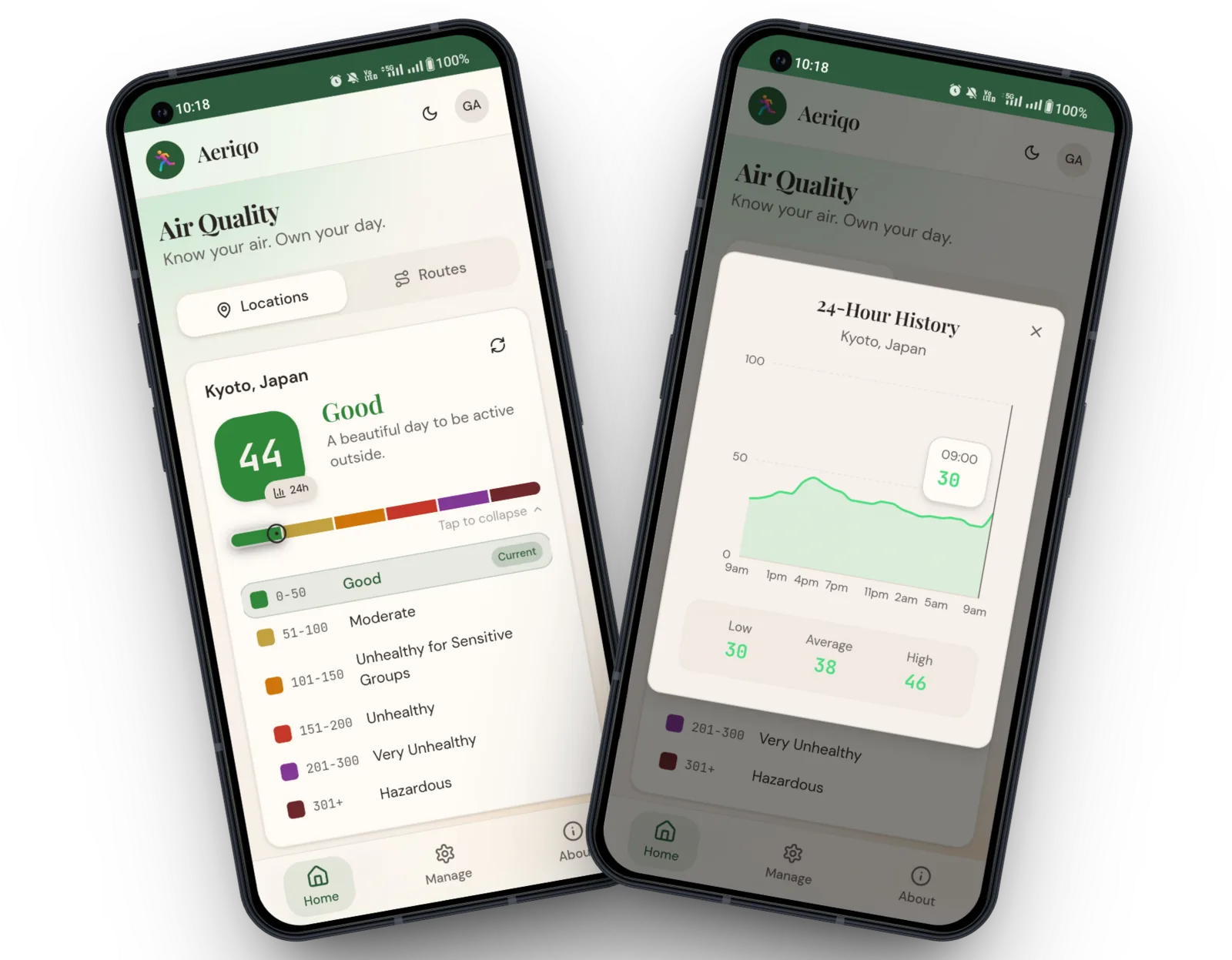
The Training Conditions Score (0-100) combines air quality, temperature, wind, rain, humidity, and UV into a single number, so runners, cyclists, and hikers don't have to check six different apps before heading out.
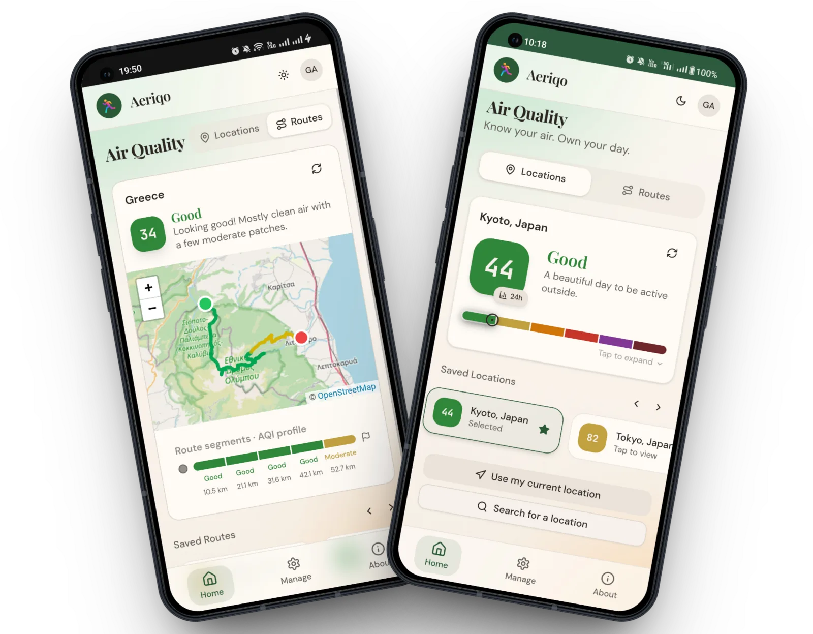
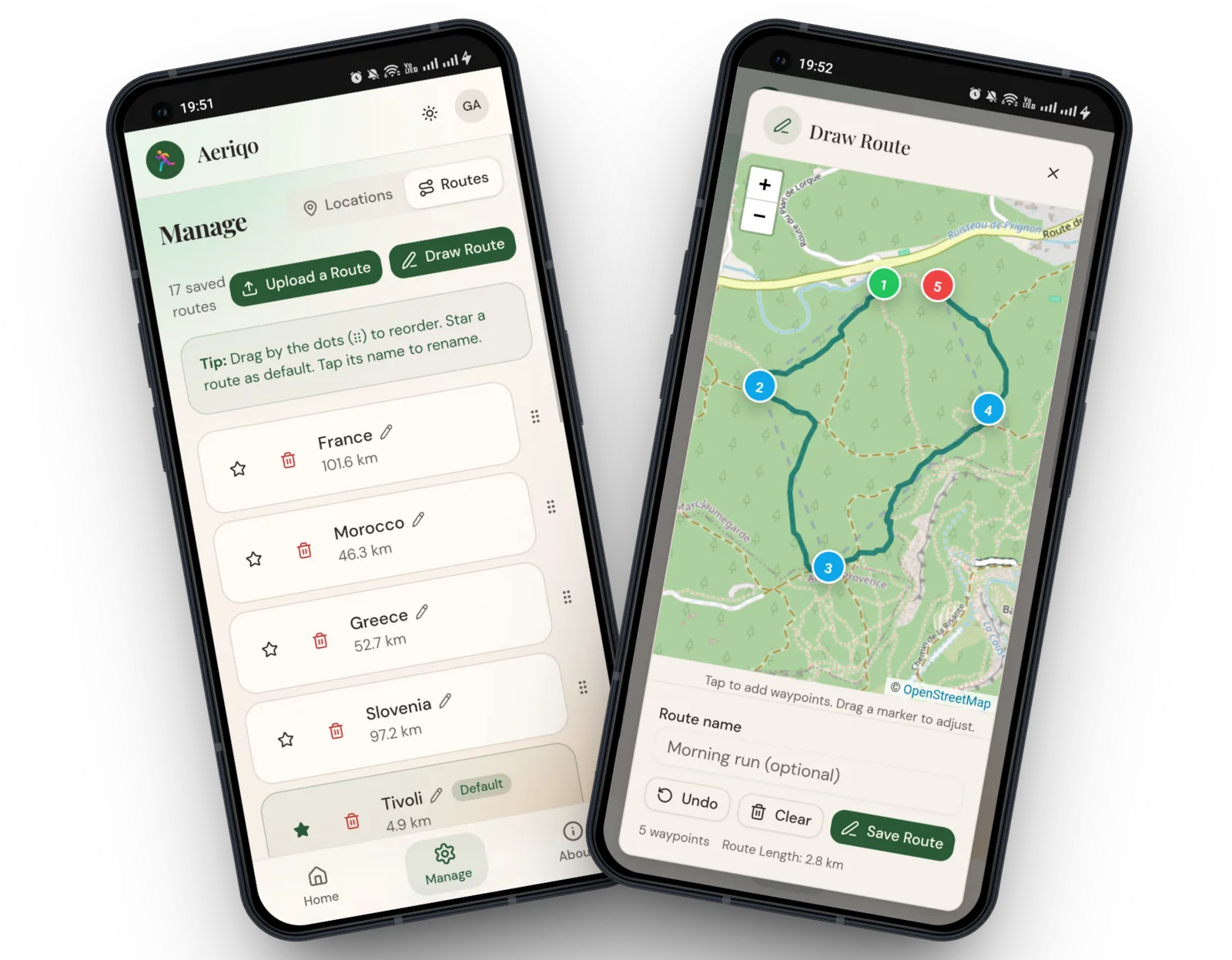
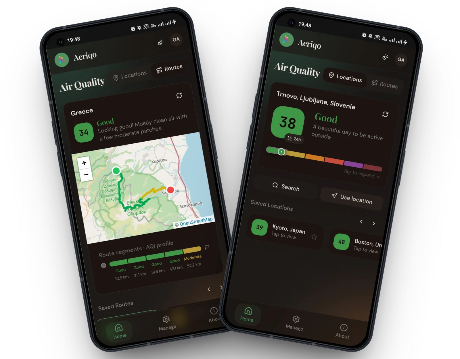
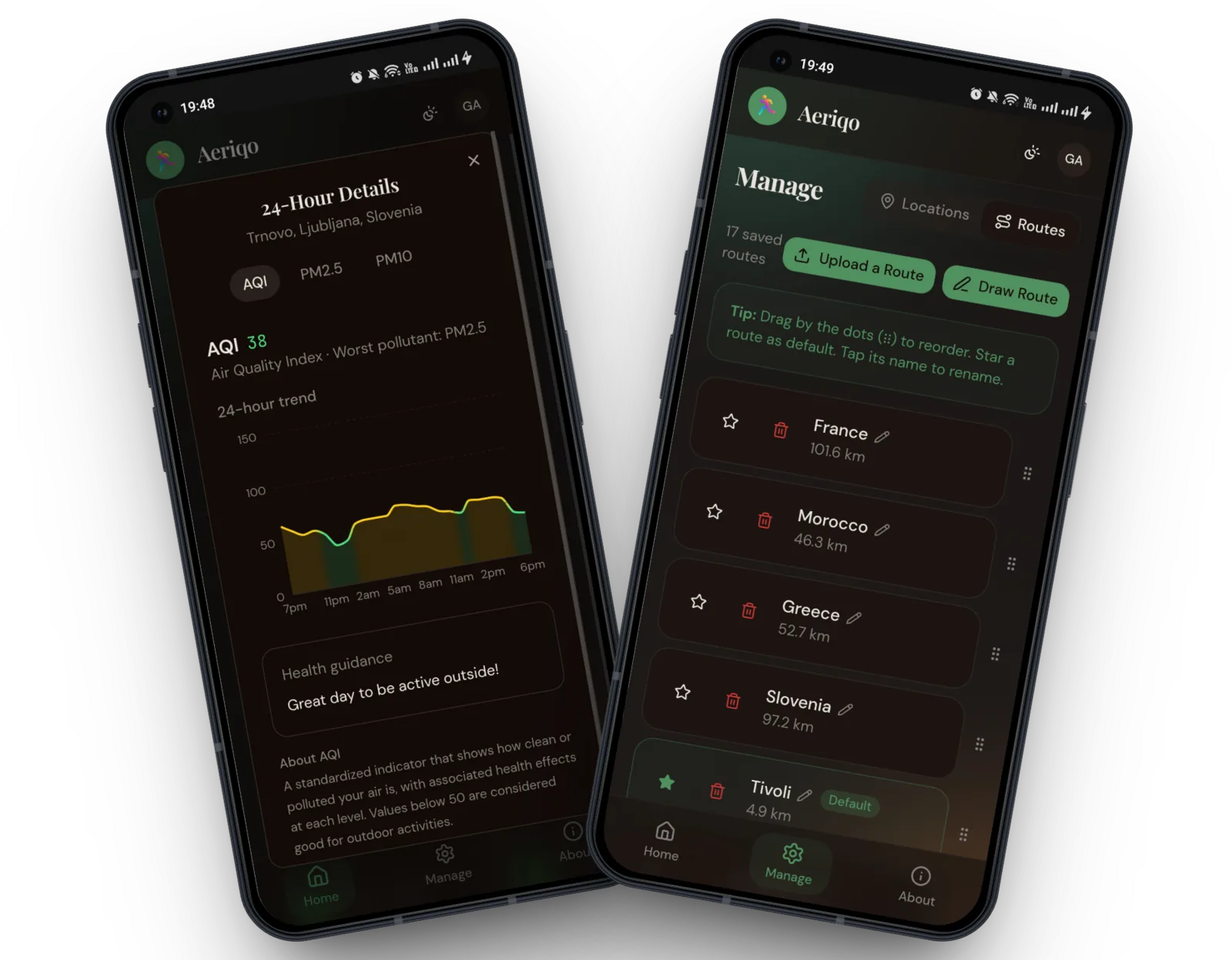
Beyond the score, Aeriqo analyzes your actual routes. Upload a GPX/TCX file, import from Strava, or draw a route on the map, and see segment-by-segment air quality along your exact path. A 4-day forecast suggests the best time of day to be active, and smart alerts notify you when air quality changes at your saved locations.
Aeriqo also tracks pollen by type (grass, birch, olive, and more), Saharan dust, and wildfire smoke, with hourly trend charts so you can plan around the worst hours. It works worldwide, is free to start, and runs right in your browser with no app to install.
Features
- Training Conditions Score: one 0-100 score combining air quality, temperature, wind, rain, humidity, and UV
- Route AQI analysis: upload GPX/TCX, import from Strava, or draw on the map, then see air quality segment by segment along your path
- 4-day forecast with best-time-of-day suggestions
- Smart alerts with custom AQI thresholds, daily forecast alerts, per-location control, and quiet hours
- Pollen forecast by type (grass, birch, olive, and more) with hourly trend charts
- Saharan dust and wildfire smoke tracking with hourly forecasts
- Works worldwide, right in your browser, and installable as a PWA
Use Cases
- Runners deciding whether to head out now or wait for a cleaner-air window
- Cyclists checking pollution exposure along a planned route before riding
- Commuter cyclists comparing routes to minimize daily pollution dose
- Allergy sufferers planning workouts around peak pollen hours
- Athletes in wildfire- or dust-affected regions timing training around smoke events
- Parents and coaches checking if conditions are safe for outdoor practice

Comments


Hi everyone, maker of Aeriqo here. The idea came from my own pre-run routine: one app for the weather, another for wind, another for air quality, and then a guess about whether the combination was actually fine. Each app said "moderate" about something, and none of them answered the only question I had: should I go now, later, or not at all? So I built a single Training Conditions Score from 0 to 100 that combines air quality, temperature, wind, rain, humidity, and UV, including how the factors interact (heat plus humidity is worse than either alone). The second thing I kept running into: city-wide AQI is misleading. Air quality on a busy road and in a park 500 meters away can be completely different. So Aeriqo analyzes your actual route, segment by segment. Upload a GPX file, import from Strava, or draw the route on the map. It runs in the browser, works worldwide, and is free to start. I would genuinely love feedback, especially from runners and cyclists: what would make you check this before a session instead of your weather app? Happy to answer anything.
Summer sale: 70% off Aeriqo Pro for 6 months Excited to be announcing a 2026 summer sale: 70% off Aeriqo Pro 🎉 Until 31 August, enter code SUMMER26 at checkout for Pro at $1.49/month instead of $4.99, for your next 6 months. Pro unlocks unlimited route analysis, 4-day forecasts with best-time windows, up to 50 saved locations and 20 routes, and alerts when conditions change. https://www.aeriqo.app Applies to the Pro monthly plan. Renews at the regular price after 6 months. Cancel anytime.

Premium Products




































Sponsors
Buy
Makers
Makers
Comments
Hi everyone, maker of Aeriqo here. The idea came from my own pre-run routine: one app for the weather, another for wind, another for air quality, and then a guess about whether the combination was actually fine. Each app said "moderate" about something, and none of them answered the only question I had: should I go now, later, or not at all? So I built a single Training Conditions Score from 0 to 100 that combines air quality, temperature, wind, rain, humidity, and UV, including how the factors interact (heat plus humidity is worse than either alone). The second thing I kept running into: city-wide AQI is misleading. Air quality on a busy road and in a park 500 meters away can be completely different. So Aeriqo analyzes your actual route, segment by segment. Upload a GPX file, import from Strava, or draw the route on the map. It runs in the browser, works worldwide, and is free to start. I would genuinely love feedback, especially from runners and cyclists: what would make you check this before a session instead of your weather app? Happy to answer anything.
Summer sale: 70% off Aeriqo Pro for 6 months Excited to be announcing a 2026 summer sale: 70% off Aeriqo Pro 🎉 Until 31 August, enter code SUMMER26 at checkout for Pro at $1.49/month instead of $4.99, for your next 6 months. Pro unlocks unlimited route analysis, 4-day forecasts with best-time windows, up to 50 saved locations and 20 routes, and alerts when conditions change. https://www.aeriqo.app Applies to the Pro monthly plan. Renews at the regular price after 6 months. Cancel anytime.
Premium Products
New to Fazier?

Find your next favorite product or submit your own. Made by @FalakDigital.
Copyright ©2026. All Rights Reserved