
GeoMaps
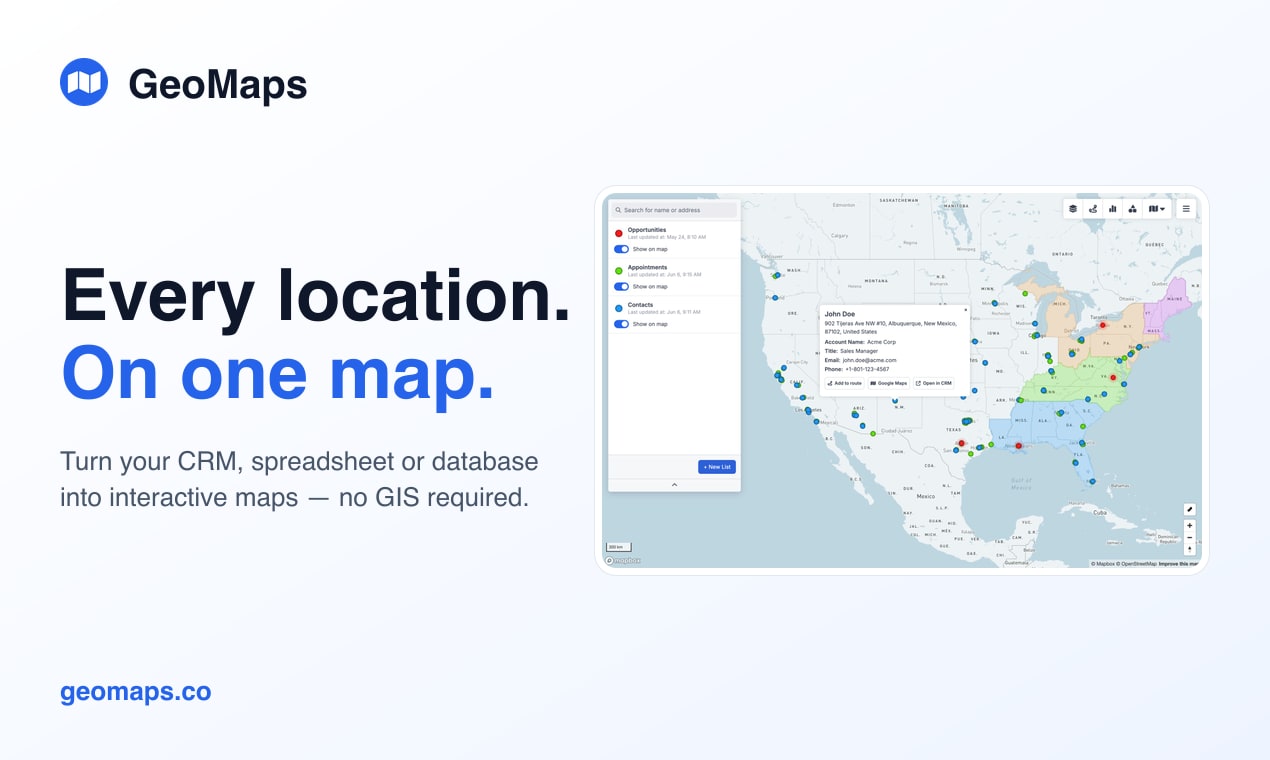
Turn your CRM or spreadsheet into an interactive map
GeoMaps turns your spreadsheet, CRM or database into an interactive map — no GIS skills required. Connect your data (or upload a file) and every record is geocoded and kept in sync automatically. From there, generate a map with AI, plan optimized routes, draw territories, add heatmaps and demographics, and publish shareable maps. Free for up to 1,000 locations — geomaps.co
Features
- AI map builder — describe the map you want and it builds it
- 20+ native integrations — Google Sheets, Excel, HubSpot, Pipedrive, Zoho, monday and more, with live sync
- Automatic geocoding of every address — no coordinate columns
- Style & filter markers by any field, with saved views
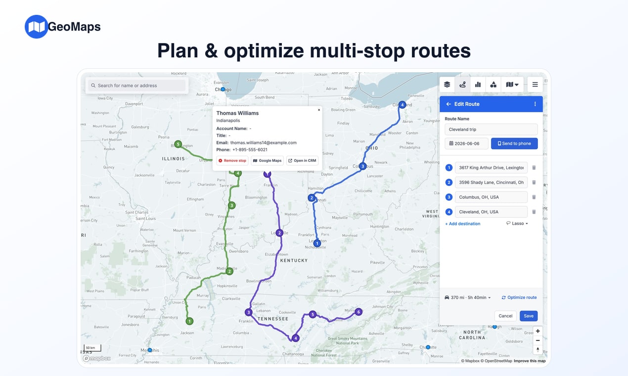
- Optimized multi-stop route planning for field teams
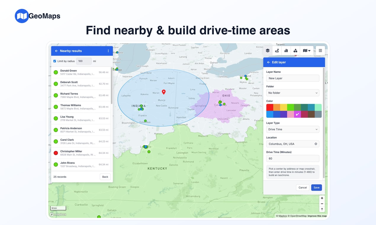
- Territories & layers — drive-time areas, radius rings, shapefile import
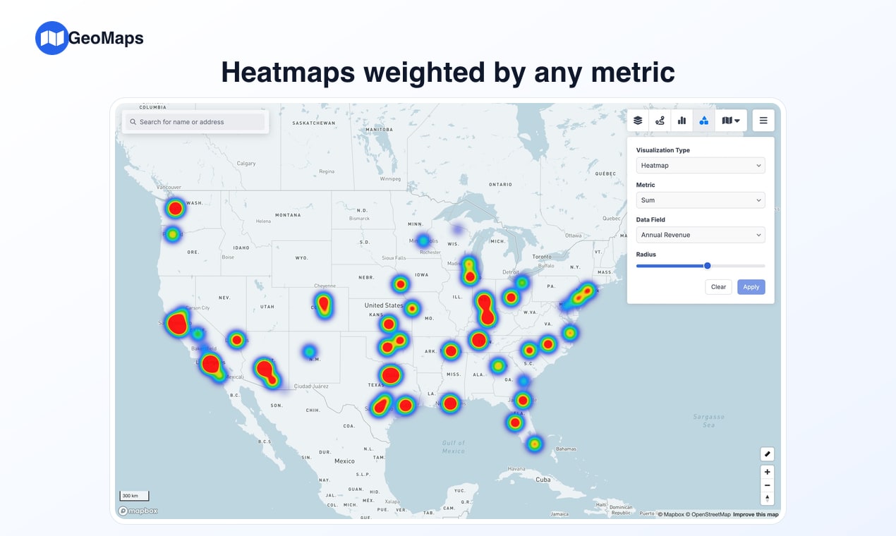
- Visualizations — heatmaps, clusters, H3 hexagons, demographic data
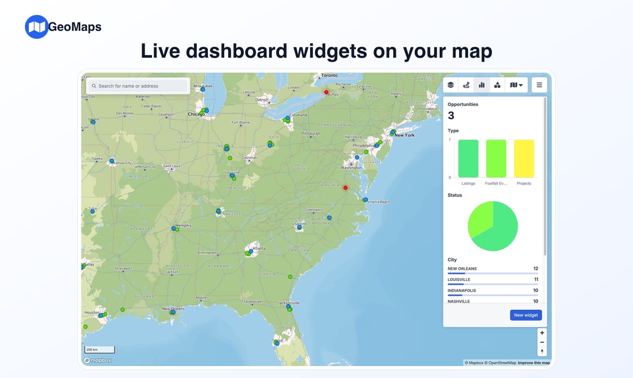
- Live dashboard widgets that update as you filter the map
- Publish & share — public or password-protected, embeddable maps
- Free plan (1,000 locations); Pro $25/mo, Enterprise $99/mo
Use Cases
- Sales & RevOps — visualize your pipeline, balance territories, spot whitespace
- Field sales & service — route reps efficiently, plan the day's visits, find what's nearby
- Retail & franchise — store-performance maps, site selection, coverage gaps
- Delivery & logistics — depot catchments, drive-time zones, route density
- Marketing — map customers by region, plan events and campaigns by location
- Real estate — plot listings, analyze markets and territories
- Anyone with addresses in a CRM or spreadsheet who wants to see and act on them geographically

Comments


Hey everyone 👋 I'm Erik, the maker of GeoMaps. I kept hitting the same problem: the most location-rich data a team has — customers, leads, stores, field assets — sits in a CRM or spreadsheet where you can't actually see it. The existing tools either needed real GIS expertise or made me re-export a CSV every single time the data changed. So I built GeoMaps. Connect Google Sheets, Excel, HubSpot, Pipedrive, Zoho and 20+ more (or upload a file), and every record is geocoded and kept in sync automatically. From there you can generate a map with AI from a plain-language prompt, plan optimized routes, draw territories, add heatmaps and demographics, and publish shareable maps. It's free for up to 1,000 locations. I'd genuinely love your feedback — especially what you'd map first, and anywhere the flow felt confusing. I'll be around all day to answer 🙏
Premium Products


Sponsors
BuyMakers
Makers
Comments
Hey everyone 👋 I'm Erik, the maker of GeoMaps. I kept hitting the same problem: the most location-rich data a team has — customers, leads, stores, field assets — sits in a CRM or spreadsheet where you can't actually see it. The existing tools either needed real GIS expertise or made me re-export a CSV every single time the data changed. So I built GeoMaps. Connect Google Sheets, Excel, HubSpot, Pipedrive, Zoho and 20+ more (or upload a file), and every record is geocoded and kept in sync automatically. From there you can generate a map with AI from a plain-language prompt, plan optimized routes, draw territories, add heatmaps and demographics, and publish shareable maps. It's free for up to 1,000 locations. I'd genuinely love your feedback — especially what you'd map first, and anywhere the flow felt confusing. I'll be around all day to answer 🙏
Premium Products
New to Fazier?

Find your next favorite product or submit your own. Made by @FalakDigital.
Copyright ©2025. All Rights Reserved